
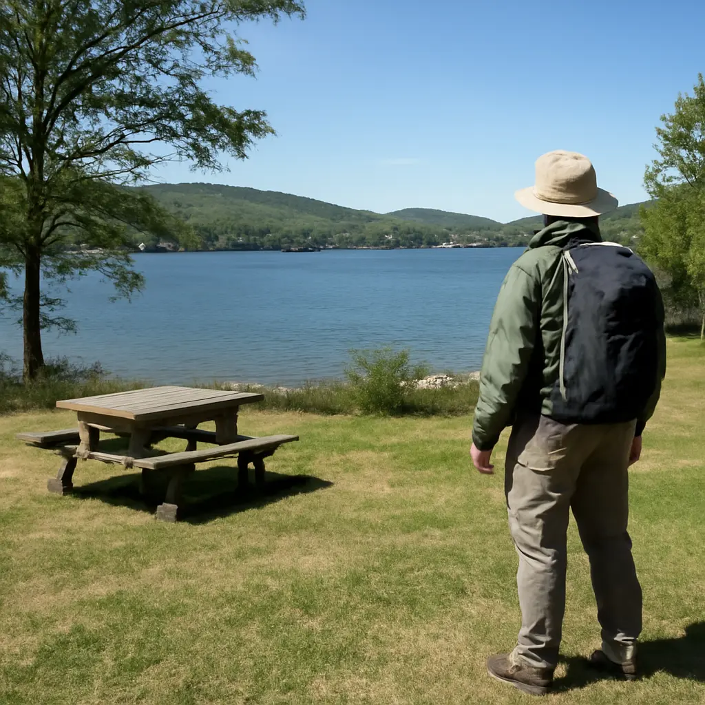
Scouting a picnic area beside a lake means assessing more than the view: an experienced outdoors person checks access, shade, wind, water conditions, hazards, facilities, and the effects of weather before choosing a spot. The best site is comfortable without putting people, food, or wildlife at risk. A deliberate survey—starting on higher, stable ground and then checking the route to the shore—helps avoid common problems such as sudden water-level changes, slippery banks, insects, and exposure. The guidance below explains how to evaluate a site, compare different kinds of picnic areas, and leave the shoreline in good condition.
Site selection for lakeside picnic areas
A picnic area is a place chosen for eating and resting outdoors; a lakeside picnic area adds the distinct considerations of nearby water, shoreline terrain, and changing weather. There is no single official definition that guarantees a site is safe or suitable. Instead, assess it against your group’s needs and the conditions on the day. The National Park Service’s Leave No Trace guidance emphasizes planning ahead, using durable surfaces, and disposing of waste properly—principles that apply whether you are at a developed lakeside table or an undeveloped shore.
Think of the choice as a balance among comfort, safety, access, and impact. A level, shaded table may be ideal for a family but difficult to reach for someone with limited mobility; a quiet cove may feel private but offer poor visibility and a steep, unstable bank. The following checks help distinguish a genuinely suitable site from one that merely looks inviting.
Access, terrain, and a stable footprint
Start by examining the whole approach, not just the place where you intend to sit. Look for a firm, reasonably level surface, a clear route back to the parking area, and enough room for the group to gather without trampling vegetation. Avoid eroding banks, loose rocks, exposed roots, muddy depressions, and areas where rainwater visibly channels toward the lake. For an accessible outing, check the actual route, slope, surface, and distance to amenities rather than assuming a nearby picnic table is reachable.
Choose a spot set back from the water’s edge, especially where the bank is steep, undercut, or slippery. A short walk to the shore is usually preferable to placing food and chairs on a narrow bank. Keep children and pets within active supervision near water; the U.S. Centers for Disease Control and Prevention identifies drowning as a serious, preventable hazard and advises close, constant supervision of children around water.
Shade, wind, and exposure
Shade is useful for comfort and for keeping food out of direct sun, but inspect overhead branches before settling beneath a tree. Dead limbs, cracked trunks, and trees leaning over the site can become hazards, particularly in wind. Also note whether shade will last through your planned visit: the sun’s angle changes, and a spot shaded at arrival may become exposed later.
Lakes can feel breezy even when nearby woods are calm. Observe flags, leaves, water ripples, and the direction smoke or loose clothing moves, if present. A light breeze may deter some insects, while strong gusts can scatter napkins, tip lightweight chairs, or make a lakeside meal uncomfortable. The National Weather Service recommends checking the forecast and being alert to rapidly changing conditions; postpone or relocate if thunderstorms, strong winds, or other hazardous weather are expected.
Shoreline and water conditions at picnic areas
A lake’s edge is a changing boundary, not a fixed amenity. Water levels can rise or fall with rainfall, dam operations, seasonal patterns, or local management, and shorelines may conceal soft mud, drop-offs, or submerged debris. The U.S. Geological Survey describes water quality as the suitability of water for a particular use based on physical, chemical, and biological characteristics. That distinction matters: clear-looking water is not proof that it is safe to drink, swim in, or let pets enter.
Water levels, banks, and access to the shore
Scan the shoreline for water marks, wet soil, stranded plants, and signs that waves or recent rain have reached the proposed site. Choose ground above the active waterline and away from drainage channels. Avoid standing or placing gear on undercut banks, which can collapse unexpectedly, and do not assume a gentle-looking surface remains shallow underwater. If the lake is managed by a dam or reservoir, follow posted warnings and local recreation guidance because levels and currents may change.
If the group plans to swim or wade, treat that as a separate activity requiring its own safety check. Use designated swimming areas when available, obey closures and signs, and do not enter water where visibility, depth, or conditions are uncertain. The CDC recommends using a life jacket for people who are weak or inexperienced swimmers and maintaining close supervision of children; a picnic site should not be treated as a supervised swimming beach unless it is explicitly designated and managed as one.
Water quality, algae, and wildlife
Before visiting, check the lake manager, local health department, or park authority for advisories. Harmful algal blooms can produce toxins, and the U.S. Environmental Protection Agency advises people to avoid water that looks like paint, scum, or thick mats and to keep people and pets away from suspicious blooms. Do not drink untreated lake water; use potable water brought from home or a designated drinking-water source. When an advisory is posted, follow it even if the water appears clear.
Notice wildlife activity without approaching or feeding animals. Keep food sealed, supervise pets, and give nesting birds and other wildlife space. Feeding wildlife can alter natural behavior and draw animals toward people, while food scraps can attract scavengers long after a group leaves. A quiet site with a little distance from animal paths is generally better than a location directly beside nests, burrows, or heavily used access points.
Facilities and practical comfort at lakeside picnic areas
Once the natural setting passes the safety check, assess how well the site supports the outing. Developed picnic areas may provide tables, toilets, potable water, bins, or grills; primitive areas may provide none. The U.S. Forest Service and National Park Service both advise visitors to plan for the facilities available at a particular site rather than assume services are present. Confirm operating hours, reservations, fire rules, and seasonal closures with the managing agency.
Toilets, drinking water, and waste facilities
Locate toilets and drinking water before choosing a table, especially when traveling with children or anyone who needs frequent access. If potable water is unavailable, bring enough for drinking, hand cleaning, and food preparation; never rely on lake water without appropriate treatment. Check whether bins are provided, but be prepared to pack out all rubbish if they are full or absent. Leave the area cleaner than you found it, and keep food scraps out of the water and surrounding vegetation.
Food safety is part of site scouting. The U.S. Department of Agriculture advises keeping perishable food cold and limiting the time it spends in the temperature danger zone; use an insulated cooler with ice or frozen packs, keep it closed, and avoid setting food directly on warm ground. A shaded, stable surface away from standing water and insects makes food handling easier, but shade does not replace temperature control.
Crowds, noise, and privacy
Walk the area briefly before unloading. Note how close neighboring groups are, whether a boat launch or trail brings steady foot traffic past the table, and whether noise carries across the water. A site near a restroom may be convenient but busy; a secluded cove may offer quiet but have a longer, rougher access route. Choose a location that fits the group rather than treating remoteness as automatically better.
For larger gatherings, check posted group-use rules and reservation requirements. Keep pathways, boat launches, and accessible routes clear, and avoid spreading equipment across neighboring sites. Where fires or charcoal grills are permitted, use only designated facilities and obey current fire restrictions; never leave a flame unattended.
A field method for scouting picnic areas
Experienced visitors make a quick, repeatable survey before unpacking. This reduces the temptation to commit to the first attractive patch of shore and helps the group adapt when conditions differ from expectations.
The five-minute site scan
- Pause at the entrance and read signs for closures, swimming warnings, fire rules, and wildlife notices.
- Check the weather, wind direction, shade, and overhead branches; identify a safer fallback spot if conditions change.
- Walk the route and inspect the ground for steep slopes, unstable banks, mud, sharp debris, and drainage paths.
- Locate toilets, potable water, waste facilities, and any designated swimming or cooking areas.
- Choose a durable surface set back from the water, keep food secure, and agree on boundaries for children and pets.
This scan is a practical decision aid, not a substitute for local rules or judgment. If the site has a posted hazard, visible bloom, unstable bank, or severe-weather warning, select another location or leave. A useful mental “site score” can compare access, shade, safety, facilities, and crowding, but any serious safety concern should outweigh a high comfort score.
Example: choosing between a scenic cove and a developed table
Imagine a group comparing a secluded cove with a table near a managed beach. The cove is quiet and shaded, but its narrow path crosses a muddy slope and the bank is undercut. The developed table is busier, yet it has a stable surface, nearby toilets, posted swimming guidance, and a clear route for a stroller. For a mixed-age group or a windy day, the table is the more responsible choice. If the cove’s access and bank were stable and the group did not need nearby facilities, it might be suitable—provided the group still followed shoreline and wildlife precautions.
The example illustrates a core field principle: evaluate the entire outing, including the walk in and the exit, rather than judging a site by scenery alone. Reassess if rain begins, water rises, wind strengthens, or the area becomes crowded.
Conclusion: choose a lakeside picnic area with care
Good lakeside picnic-area scouting combines stable access, suitable shade and wind protection, safe distance from changing water, current water-quality information, useful facilities, and respect for wildlife. Check the approach and shoreline before unpacking, use designated areas for swimming and fires, bring safe drinking water and food storage, and follow local advisories. These small decisions make outings more comfortable while reducing risks to visitors and the lake itself. Before your next trip, review the managing agency’s conditions, then take a few minutes on arrival to choose a spot that is safe, practical, and durable.
Sources: National Park Service, Leave No Trace Seven Principles, https://www.nps.gov/articles/leave-no-trace-seven-principles.htm; U.S. Centers for Disease Control and Prevention, Drowning Prevention, https://www.cdc.gov/drowning/prevention/index.html; National Weather Service, Weather Safety, https://www.weather.gov/safety/; U.S. Geological Survey, Water Quality, https://www.usgs.gov/special-topics/water-science-school/science/water-quality; U.S. Environmental Protection Agency, Harmful Algal Blooms, https://www.epa.gov/habs; U.S. Forest Service, Leave No Trace, https://www.fs.usda.gov/visit/know-before-you-go/leave-no-trace; U.S. Department of Agriculture, Food Safety While Hiking, Camping & Boating, https://www.fsis.usda.gov/food-safety/safe-food-handling-and-preparation/food-safety-basics/food-safety-while-hiking-camping-boating.